Unlocking the Power of Global Navigation Satellite Systems via Interoperability
Introduction
In today’s rapidly advancing digital age, telematics has transformed the way people interact with connected assets, enabling them to gather valuable data for improved business intelligence, increased operational efficiencies, and enhanced asset protection.
Telematics benefits from advancements in satellite technology (read our blog “Leading the Way with GPS III Satellites and Unparalleled Accuracy” for additional details) and through increased interoperability between Global Navigation Satellite Systems (GNSS) around the world. Interoperability benefits include increasing telematics accuracy, precision, and resiliency.
GNSS Background
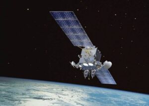
There are 4 global navigational satellites systems which are operated by the U.S., Russia, China and the EU. India and Japan have systems focused on regional coverage although focused primarily on their home countries.
| System | Country/Region | Operational Dates/Scope | # of Satellites |
| GPS | United States | 1993: Global | 31 |
| GLONASS | Russia | 2011: Global | 24 |
| BeiDou (BDS) | China | 2000: China/Asia Pacific 2020: Global | 45 (2 separate constellations) |
| Galileo | European Union | 2016: Global (Early) 2022: Global (Full) | 30 (24 satellites + 6 spares) |
| IRNSS (NavIC) | India | 2016: Regional India + | 7 (plans to increase to 11) |
| QZSS (Michibiki) | Japan | 2021: Regional Japan + | 4 (plans to increase to 11) |
Interoperability Overview
All GNSS are interoperable for civilian uses although GLONASS is problematic given differences in time systems and signal structures. For example, the U.S. and China agreed in December 2017, after 3 years of negotiations, to allow BeiDou’s civil signals to be interoperable with GPS. As a result, the three frequency bands that BeiDou satellites use to transmit navigation signals are located adjacent to or even inside GPS frequency bands.
Japan’s Michibiki system was developed by the Japanese government to enhance the U.S.-operated GPS in the Asia-Oceania regions, albeit with a specific focus on Japan. Michibiki’s goal is to provide highly precise and stable GPS-compatible positioning services in the Asia-Oceania region. Japan plans to develop their own satellite navigation system independent of GPS starting with the launch of an additional 7 satellites over the next several years.
More in-depth GNSS interoperability, however, is dictated by political and military considerations. GLONASS and BeiDou have deeply integrated systems, while the U.S. Secretary of Defense in consultation with Director of National Intelligence designated Galileo, NavIC, and Michibiki as allied navigational satellite systems in 2020.
Value of Interoperability
Greater Accuracy and Precision
Interoperable GNSS significantly increases the number of signals available which provides the following benefits:
-
- Increases navigational accuracy by improving the relative geometry between GNSS satellites and connected devices
-
- Improves visibility in regions with natural or artificial obstructions
-
- Allows higher accuracy for velocity and time determination
Increased Resiliency
Interoperability increases resiliency due to the diversity of signals and constellations used. In the event a satellite or satellites in a GNSS are having issues, other allied global or regional navigation satellites networks can provide signal continuity.
Conclusion
Positioning Universal continuously monitors relevant technological advancements, including the emergence of new regional satellite networks and improvements to existing satellite networks, in our constant quest to improve the telematics services we provide to our customers.